How Do Pilots Navigate?
Pilots navigate airplanes using visual landmarks, dead reckoning, ground-based radio aids, and satellite GPS, with support from air traffic control (ATC). Each aircraft navigation method helps pilots determine their position, follow a planned route, and reach the correct destination. Pilotage and dead reckoning provide the foundation for learning aviation navigation, while systems such as VOR, ADF, DME, ILS, GPS, RNAV, and inertial reference systems offer additional guidance. Understanding how these methods work together answers two common questions: How do pilots navigate airplanes, and how do airplanes navigate safely across long distances?
Key Takeaways
- Pilots navigate using a layered mix of visual, radio, and satellite methods — rarely just one.
- Pilotage (landmarks) and dead reckoning (time, speed, heading) are the foundation every student pilot learns first.
- Ground-based radio aids (VOR, ADF/NDB, DME, and ILS) guide pilots when visual cues aren’t enough.
- GPS and RNAV let aircraft fly direct routes between waypoints and are the primary method in most modern cockpits.
- Air traffic control supports navigation throughout the flight with traffic, weather, and routing instructions.
Aircraft Navigation Methods at a Glance
| Method | How It Works | Primary Use / Range |
|---|---|---|
| Pilotage | Read visual landmarks (rivers, roads, towns, terrain) from the window. | Short VFR flights in clear, daytime weather; the first method students learn. |
| Dead reckoning | Calculate position from time, airspeed, heading, and wind from a known fix. | Cross-country planning; a backup that layers on top of visual and electronic aids. |
| VOR | A ground VHF station transmits signals a receiver reads as a bearing (radial). | En route navigation; line-of-sight range; still used as a GPS backup. |
| ADF / NDB | A cockpit needle points toward a ground non-directional beacon. | An older aid, still used on some approaches and as a backup. |
| DME | Measures slant-range distance between the aircraft and a ground station. | Paired with VOR or ILS to fix how far the aircraft is from the station. |
| ILS | Radio beams provide lateral and vertical guidance down to a runway. | Precision approaches and landing when visibility is low. |
| GPS / RNAV | Satellite signals fix position; aircraft fly direct between waypoints. | The primary method in most modern cockpits, across all phases of flight. |
| Inertial reference (IRS) | Self-contained gyroscopes and sensors track motion with no outside signal. | Airliners; keeps working where external signals are unavailable. |
Pilotage
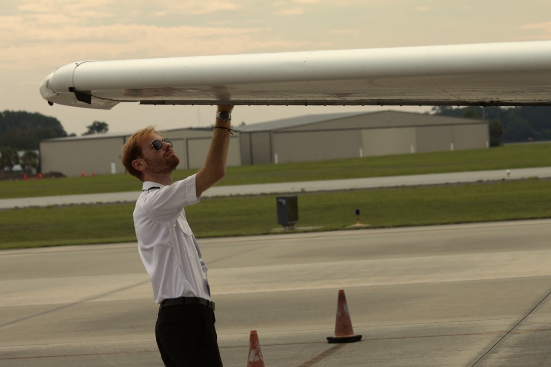
Pilotage refers to the process of looking outside of an aircraft and using visual cues. This often includes landmarks such as mountains, rivers, cities, and towers. Depending on the proximity to illuminated towers, pilots may even be able to fly using pilotage when it is dark. It is the most fundamental form of navigation in aviation, serving as the foundation for mastering other navigation techniques. Its simplicity and ease of use makes it particularly accessible for new student pilots, offering a straightforward introduction to the world of aviation navigation.
One downside to this method is that it requires unobstructed vision and cannot be used if there is a violation of the Visual Flight Rules (VFR). This includes inclement weather and objects that block windows. However, there are other options for navigation available to pilots that can bypass the weaknesses associated with pilotage.
Dead Reckoning
According to the Aircraft Owners and Pilots Association (AOPA), dead reckoning is “navigation solely by means of computations based on time, airspeed, distance, and direction.” Pilotage is a crucial part of dead reckoning, since pilots need to have a strong understanding of landscapes and checkpoints to use dead reckoning. Once pilots have a better understanding of landmarks, they can begin to get a sense for the amount of time it will take to get between various points on their flight path and start to learn how to navigate without relying on them.
Pilots perform computations using a variety of tools and navigation instruments within the flight deck, such as GPS devices, airspeed indicators, aeronautical charts, and compasses. This is often relative to a previous position, also known as a “fix.” Pilots use their distance from the fix as well as their current speed, which are obtained through tools in the flight deck, to estimate how much time it will take them to get to their next point or destination. Variable factors such as wind may be added to provide a more accurate reading.
In order to pass an FAA Practical Exam, pilots will need to know how to use dead reckoning and pilotage. Exams are taken on a specific course with its own unique landmarks, and pilots must be able to identify references while staying on a flight path to meet their requirements.
![N/A. Satellite Navigation - Global Positioning System (GPS). [photograph]. Federal Aviation Administration. https://www.faa.gov/sites/faa.gov/files/about/office_org/headquarters_offices/ato/GPSIII_satellite.png](https://media.pea.com/wp-content/uploads/2024/10/Alt-textN_A.-Satellite-Navigation-Global-Positioning-System-GPS.-photograph.-Federal-Aviation-Administration-300x162.png) GPS, RNAV, and Waypoints
GPS, RNAV, and Waypoints
The Global Positioning System (GPS) is an interconnected network of satellites that transmit radio signals to ground stations used to measure an object’s position, including its altitude, longitude, and latitude. It is one of the most reliable and commonly used forms of navigation for all individuals, regardless of whether they are pilots.
It is important to understand the terms altitude, longitude, and latitude, which determines an object’s coordinates. Altitude is the position of an object above or below sea level, while longitude and latitude measure the horizontal and vertical distance between an object and the equator respectively. The intersection of these three points generates a “coordinate” which is the exact position of an object relative to the equator.
Once the GPS has determined the position of an object, the system can calculate the physical distance between two objects as well as the time it will take to travel from one point to another.
The GPS is government operated and is usually regarded as the “universal” form of navigation due to its connections around the world. Since pilots operate on an international basis, the GPS is generally accepted as the main means of navigation in aviation. Most planes typically have some type of GPS instrument.
The Federal Aviation Administration (FAA) states that there are currently “31 GPS satellites [that] orbit the Earth at an altitude of approximately 11,000 miles providing users with accurate information on position, velocity, and time anywhere in the world and in all weather conditions.” This shows that the GPS has established a significant presence as an aid for global transportation.
According to the FAA’s Pilot’s Handbook of Aeronautical Knowledge, area navigation (RNAV) allows aircraft to follow routes between designated waypoints rather than flying directly from one ground-based navigation station to another.
In many modern aircraft, pilots enter a series of waypoints into a flight management system (FMS). The FMS uses GPS data and information from other onboard systems to calculate the route, monitor the aircraft’s progress, and estimate its arrival time. Learning to use these tools is an important part of GPS pilot training. Students may fly navigation exercises to practice entering waypoints, following programmed routes, and confirming that the aircraft remains on course. These systems give pilots greater flexibility and can support more direct, efficient flight paths.
![Staff, F. 2024. What is VOR in Aviation, and How Does it Work?. [photograph]. Flying Magazine. https://www.flyingmag.com/guides/what-is-vor-and-how-does-it-work/](https://media.pea.com/wp-content/uploads/2024/10/Staff-F.-2024.-What-is-VOR-in-Aviation-and-How-Does-it-Work_.-photograph.-Flying-Magazine.-https-__www.flyingmag.com_guides_what-is-vor-and-how-does-it-work_--300x200.webp) VOR (VHF Omnidirectional Range)
VOR (VHF Omnidirectional Range)
Very high frequency (VHF) omnidirectional range (VOR) is another type of navigation tool in the same vein as the GPS. Since the VHF predates the GPS, pilots use it less frequently. The number of VOR stations have been decreasing over the last few decades due to decommissions attributed to the FAA’s preference for GPS technology. However, VORs are still a valuable aid for navigation and serve as a backup for when the GPS goes down.
VOR technology uses the length of time, or phase difference, between a reference signal and a directional signal emitted by an antenna to determine what is known as the “VOR radial.” The VOR radial represents an aircraft’s position relative to the antenna of a ground control station. Once the VOR radial is determined, ground control sends the information to the aircraft where the pilot will then read it from an instrument. The pilot can now use this information to navigate accordingly, oftentimes to make sure that they are still on course.
While VOR technology has its limitations – such as requiring pilots to reference ground stations and typically being effective only within a 200-mile range – it has remained a reliable and well-established aviation navigation system for many decades. In contrast, GPS technology offers the advantage of global coverage. However, understanding VOR is essential for pilots, as it provides a solid foundation in navigation principles and ensures proficiency in various navigation methods.
ADF and NDB (Automatic Direction Finder)
A non-directional beacon (NDB) is a ground-based radio station that transmits a signal in all directions. The aircraft’s automatic direction finder (ADF) receives that signal and displays the relative direction of the station with a cockpit needle. Pilots can then use the indication to track toward or away from the beacon.
ADF and NDB technology is one of the older forms of airplane navigation and is less precise than VOR or GPS. However, it may still support certain instrument approaches or serve as a backup navigation aid. Its accuracy can be affected by terrain, electrical interference, nighttime conditions, and aircraft banking. Pilots learning VFR and IFR procedures should understand these limitations when interpreting ADF indications.
DME (Distance Measuring Equipment)
Distance measuring equipment (DME) tells pilots how far the aircraft is from a ground station. The airborne equipment sends an interrogation signal to the station, which responds with another signal. The system measures the elapsed time and converts it into slant-range distance, generally displayed in tenths of a nautical mile.
Because DME provides distance rather than direction, it is frequently paired with a VOR or instrument landing system (ILS). The combined information helps pilots determine both their course and their distance from a station or runway. DME is particularly useful during instrument flying because pilots can use it to identify route positions, approach fixes, and other points without relying on outside visual references.
ILS (Instrument Landing System)
An instrument landing system (ILS) provides precise lateral and vertical guidance as an aircraft approaches a runway. The localizer helps the pilot remain aligned with the runway centerline, while the glideslope indicates the proper descent path. Together, these radio signals allow the pilot to make a stable approach when clouds, fog, or other conditions restrict visibility.
Pilots typically learn to use an ILS while earning an instrument rating. Cockpit instruments show whether the aircraft is above, below, left, or right of the intended approach path, allowing the pilot to make corrections. Some ILS installations also incorporate DME or marker beacons to identify distances and approach points. Although an ILS supplies detailed guidance, pilots must still follow the published approach procedure and monitor the aircraft’s instruments throughout the descent.
Inertial Reference Systems (IRS)
An inertial reference system (IRS) uses self-contained gyroscopes and accelerometers to track an aircraft’s movement and calculate its position, speed, and direction. Because the system does not depend on radio stations or satellite signals, it remains available when external navigation signals are interrupted or unavailable.
Airliners commonly use inertial systems alongside GPS and other navigation equipment. An IRS can support the flight management system and provide a continuous reference throughout the flight. However, small position errors may accumulate over time, so external sources such as GPS may be used to update or correct its calculations.
Radio Communications with Air Traffic Control (ATC)
Communicating with Air Traffic Control (ATC) is another important aspect of navigation. Air Traffic Control constantly provides pilots with essential information, such as when to land, when to take off, updates on the weather conditions, and the presence of other aircraft, otherwise known as “air traffic. Pilots will use a specific ATC radio frequency to keep in contact with controllers.
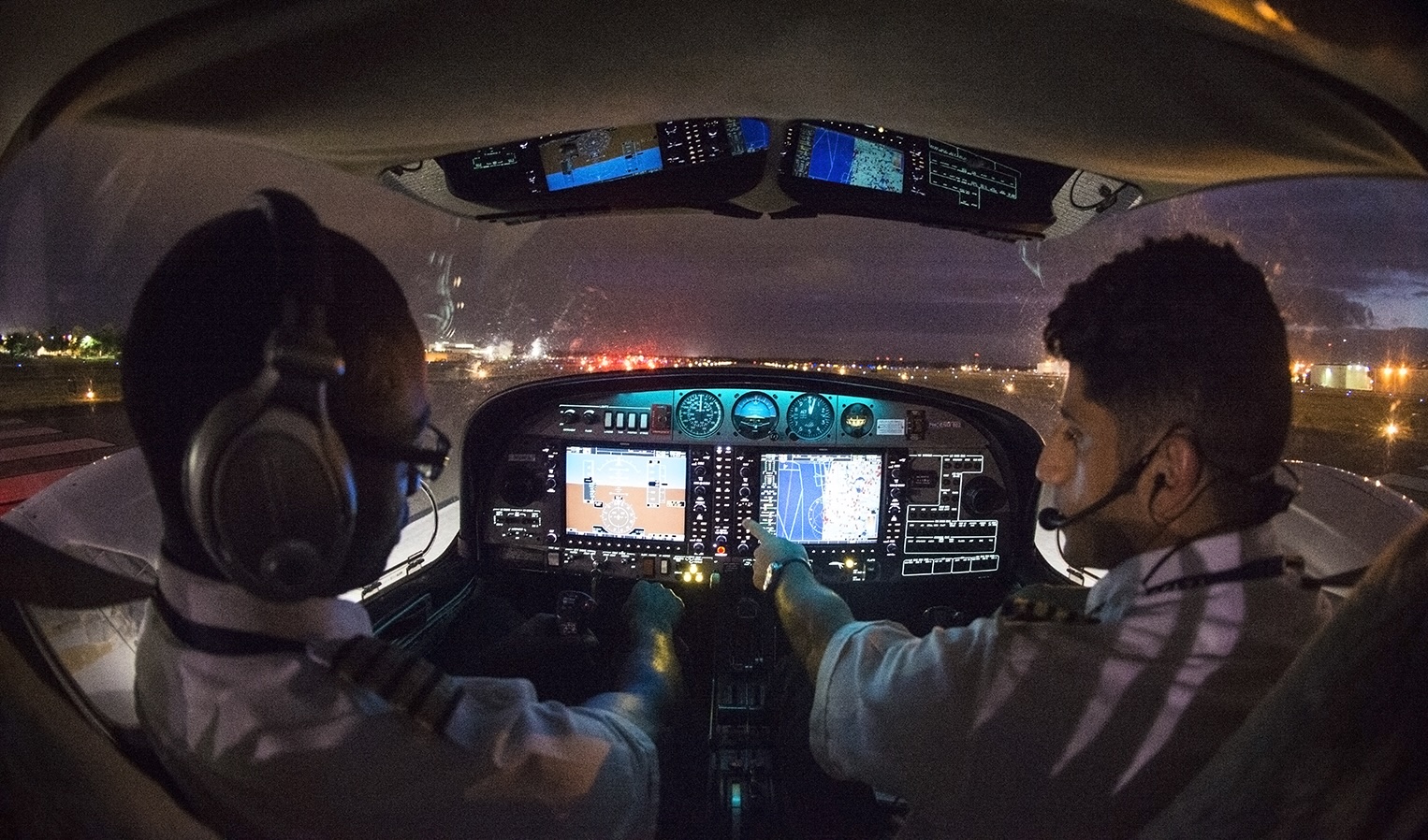
The process of communicating with ATC can be challenging for beginners, as it involves the knowledge of codes and key phrases. Phoenix East Aviation teaches their pilots the importance of ATC communication, and how to communicate with the tower during ground school. Students then apply what they learn, in the flight deck, and will practice their communication skills as they continue to fly.
The Aeronautical Aviation Manual (AIM) contains detailed information on the rules for communications between pilots and controllers, including common radio phraseology and techniques such as when to say “over” to end a transmission and how to check that the radio frequency is operating correctly.
Communicating with ATC allows pilots to navigate safely to avoid oncoming traffic and inclement weather, and also provides them with any assistance they need to stay on course.
“As students progress through their flight training, they learn to navigate using increasingly advanced methods. In the Private Pilot course, for example, students begin with traditional techniques such as pilotage and dead reckoning. Eventually, students transition to more advanced topics like radio navigation aids and GPS, helping them develop greater accuracy, proficiency, and situational awareness. As an instructor, I enjoy introducing students to new navigation concepts while continuing to reinforce the fundamental skills we teach from day one. We are always learning and developing as pilots, and PEA does a great job of providing students with the opportunities and resources for students to practice and apply these navigation concepts on a daily basis.”
– Olivia Jones, Certified Flight Instructor (CFII) at Phoenix East Aviation (PEA)
Frequently Asked Questions
How do pilots navigate?
Pilots navigate using visual landmarks, dead reckoning, ground-based radio aids, GPS, and onboard systems such as RNAV and IRS. The methods used depend on the aircraft, route, weather conditions, and available equipment, while air traffic control (ATC) provides additional routing and traffic information.
How do pilots know where to go?
Pilots know where to go by planning their route before departure and monitoring their position throughout the flight. They use aeronautical charts, headings, waypoints, navigation instruments, and ATC instructions to follow the intended route and adjust when necessary.
What is pilotage?
Pilotage is an aircraft navigation method that uses visible landmarks to determine the aircraft’s location and direction of travel. Pilots compare features such as roads, rivers, towns, airports, and terrain with the corresponding features on an aeronautical chart.
Do pilots still use GPS and radio navigation together?
Yes, pilots may use GPS and radio navigation together to confirm their position and maintain access to another source of guidance. Ground-based systems such as VOR, DME, and ILS continue to support en route navigation and instrument approaches, even as GPS and RNAV have become common in modern cockpits.
How did pilots navigate before GPS?
Before GPS, pilots relied on pilotage, dead reckoning, aeronautical charts, celestial navigation, and ground-based radio aids. Depending on the aircraft and route, an aviation navigator or pilot could use systems such as NDB, ADF, VOR, and DME to determine their position and remain on course.
Learn to Navigate with Phoenix East Aviation
Mastering navigation is one of the first milestones on the path to becoming a pilot. Phoenix East Aviation trains students in every method covered here, from pilotage to GPS, through ground school and in-flight instruction.
Ready to start? Contact info2@pea.com to get in touch with their Admissions Department.
References:
https://www.faa.gov/air_traffic/publications/atpubs/aim_html/chap_4.html
https://www.faa.gov/about/office_org/headquarters_offices/ato/service_units/techops/navservices/gnss/gps
https://www.aopa.org/news-and-media/all-news/2016/march/flight-training-magazine/technique-pilotage-and-dead-reckoning
https://www.flyingmag.com/guides/what-is-vor-and-how-does-it-work/